🌋 🌊
Background
The area surrounding Kagoshima has a substantial volcanic history, with many active volcanoes and calderas present. Subsequently, multiple tephra layers are preserved in the sediment, originating from nearby eruptions and those further afield, such as the 7.3 ka eruption of Kikai Caldera. The area is archaeologically significant, as many pottery artefacts exist from early settlements, some dating back to the Jomon period. This makes Kagoshima an excellent study site for archaeologists interested in early human migration and settlement, and for Earth Scientists interested in the well-preserved eruption layers.


Notable eruptions preserved in the area include the Kikai-Akahoya (K-Ah) eruption at approximately 7.3 ka, the Ikeda Caldera eruption (4.8 ka), and multiple Kaimondake eruptions. The layers are easily identifiable, which allows researchers to track the extents of an eruption over a large area. Additionally, due to how well the layers are preserved, it’s possible to determine the different stages of a single eruption. For example, we noted the different stages in the Ikeda eruption. Layers may represent the initial explosion (which contains surface material), the pyroclastic flow, and tephra. Such comprehensive, well-preserved sedimentary deposits are unusual, making Kagoshima an excellent and unique study site.
Additionally, knowledge of the eruptions in this area could help determine whether any tsunami wave deposits found further south on Yakushima Island could be due to a volcanogenic tsunami triggered by Kaimondake. Furthermore, the trip to Kagoshima gave us an opportunity to connect with archaeologists and fellow researchers at the site.
Aim: Create an age model of sedimentary layers to refine
our understanding of volcanism near Kagoshima.
Activities carried out
Since the dates of many eruption layers are known, they provide a good reference point. When radiocarbon dating the sediment layers, its helpful to compare them to known tephra ages.
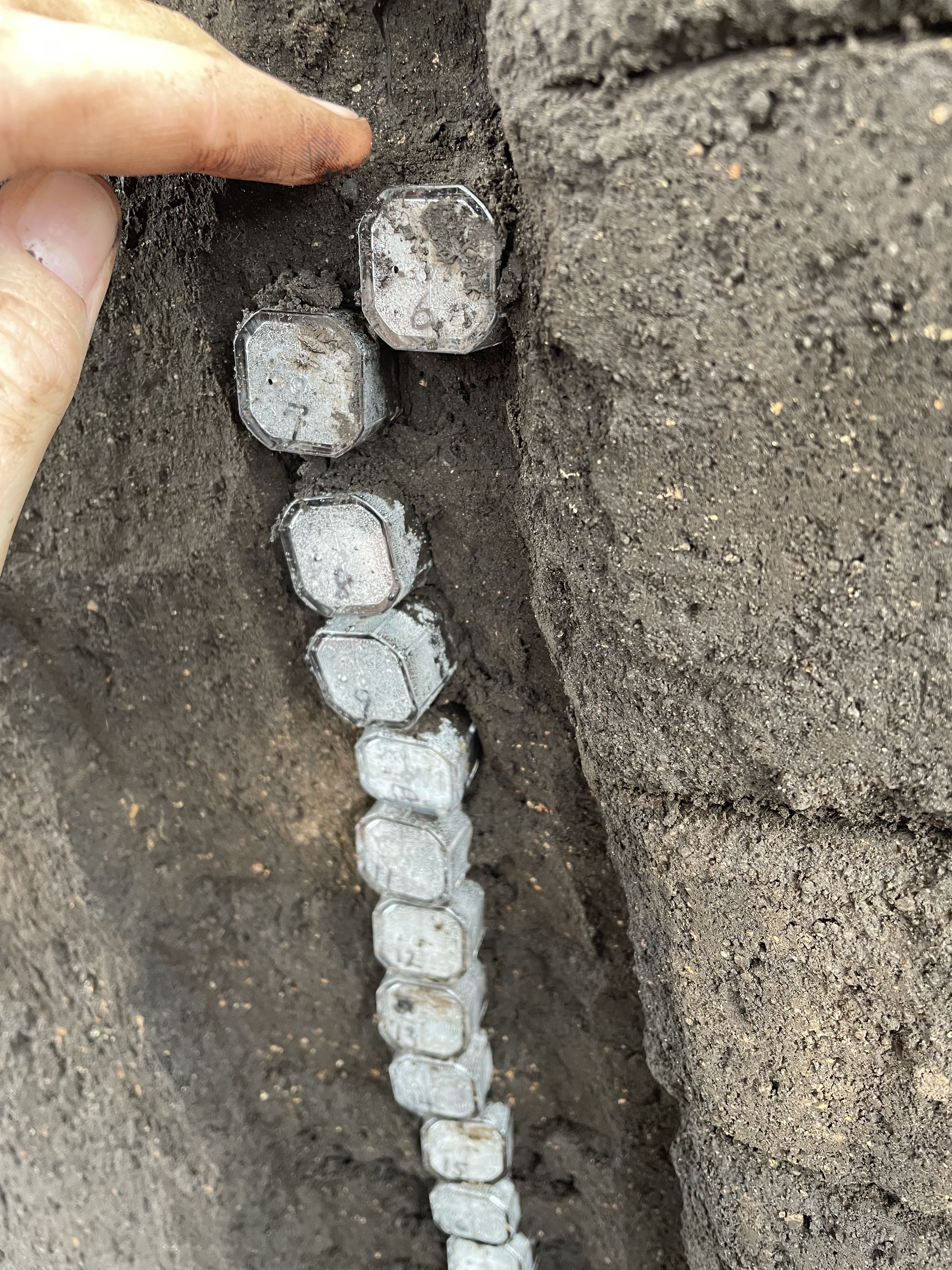
We collected samples from three sites: one near Kirishima, and two near Shibushi. At each site, pre-cut trenches were available to collect fresh material, as archaeological excavation is currently underway. Using small plastic sampling containers, we performed a vertical transect from the ground surface downwards. Additionally, we were able to view some of the pottery and stone tools which had been excavated. This included microblades, stone cutters and carvers, and the edge of an axe.


Application to research
These samples will be useful to my master’s thesis, as I’m seeking an explanation for the coastal boulder deposits on Yakushima Island (south of Kagoshima). One possibility is that a volcanic eruption may have generated a tsunami that struck the island. Kaimondake and Sakurajima (part of Ata Caldera) are volcanoes of interest, as is the large caldera itself. Additionally, the K-Ah eruption, which is preserved by a prominent tephra layer, is thought to have generated a large tsunami on Yakushima at 7.3 ka.
Future work
Due to
timing constraints, I will only analyse a selection of the sediment samples
during my master’s. In future, more of the samples can be analysed and used to expand
on our knowledge of natural hazards in southern Japan 🌋
