Kikai Island is an island formed by the uplift of coral reefs in the Pacific Ocean with a current average annual uplift of about 2 mm. It is located in the east of Amami Islands and it is about 380 kilometers south of Kagoshima Prefecture.

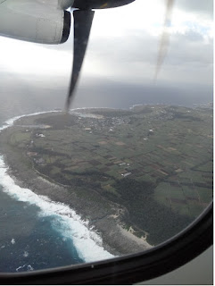
A view of Kikai Island
Although I checked the Kikai Island wind speed data before and found that the wind speed in winter would exceed 5 m/s, I experienced the strong wind when I came out of the airport (it even affected our flights).

Information about the formation process, topography and coral reefs of Kikai Island
Muto-san in the Agriculture Promotion Division and Ichiji-san introduced the basic situation and provided a map of water intake facilities on the Kikai Island.

Map of water intake facilities in Kikai Island
Water sampling processes
l Some of the sampling sites in the map were determined under the guidance of Ichiji-san and the help of some staffs.
l Draw flowing water out, rinse the bottle for several times with water, then fill and seal the bottles.
l The water samples for 14C measurement were filled in glass bottles, and the water samples for uranium measurement were filled in plastic bottles. The glass bottles used for 14C measurement were wrapped in aluminum foil.
l Rinse and fill a bucket with water and measure the water temperature.
lRecord the sampling time, GPS number (corresponded to latitude and longitude), water temperature and bottle number in the table.
Coral sampling
Porites and Favia corals were found and sampled with a hammer on the hillside next to the road.


Upper: Porites coral Bottom: Favia coral
In addition, on the way to sampling sites, Ichiji-san and other staffs also showed the sediment cores collected from Kikai Island and the local agricultural products such as coffee and orange.
Kikaicho buried cultural properties center (喜界町埋蔵文化財センター)
This center exhibited the "Gusuku relics (城久遺跡)" and the unearthed cultural relics from the Jomon period (縄文時代) to the Middle Ages.
Many ancient architectural sites and tombs have been identified in these relics. Among the unearthed objects are ceramics from Japan, China, the Korean Peninsula and other places. These different producing areas of earthenware and other products in the relics can reflect the trading routes of Kyushu and Nansei Islands in history. The soil profile of the excavated relics is also displayed in the center.

The earthenware in the Jomon period

The earthenware in the Gusuku relics

The porcelain bowls in the Gusuku relics

Soil profile of Kawajiri relics