3/08/2019

国際研修Iから帰ってきました! (26 Feb. ~ 6 Mar. 2019)


こんにちは!M1の太田です。
オーストラリアでの国際研修Iが終了しました!

長かったようで短かった7日間、オーストラリアの広大な地質やANU、ウーロンゴン大学、シドニー大学への訪問を通して言葉にできないほど多くのことを学びました。とても充実した集中講義でした。

7日間の様子は下記のリンクから見ることができます。
最終日のGroup reportもこちらに上がっています!ぜひご覧ください!
http://aces.aori.u-tokyo.ac.jp/yokoyama/australia-excursion/


3/07/2019

New Papers 2019/2/25-3/3 (AGU, EGU, GSA)

New Papers 2019/2/25-3/3 (AGU, EGU, GSA)

Geochemistry, Geophysics, Geosystems

1.    Constraining the Early Eruptive History of the Mono Craters Rhyolites, California, based on 238U–230Th Isochron Dating of their Explosive and Effusive Products
Mae Marcaida  Jorge A. Vazquez  Mark E. Stelten  Jonathan S. Miller

2.    Reef‐scale‐dependent response of massive Porites corals from the central Indian Ocean to prolonged thermal stress – evidence from coral Sr/Ca measurements
Maike Leupold  Miriam Pfeiffer  Dieter Garbe‐Schönberg  Charles Sheppard

Geophysical Research Letters

3.    The impact of strong El Niño and La Niña events on the North Atlantic
S. C. Hardiman  N. J. Dunstone  A. A. Scaife  D. M. Smith  S. Ineson  J. Lim  D. Fereday

Climate of the Past

4.    On the validity of foraminifera-based ENSO reconstructions
Brett Metcalfe, Bryan C. Lougheed, Claire Waelbroeck, and Didier M. Roche
5.     
Intra-seasonal hydrological processes on the western Tibetan Plateau: Monsoonal and convective rainfall events ∼7.5 ka ago
Linda Taft, Uwe Wiechert, Christian Albrecht, Christian Leipe, Sumiko Tsukamoto4, Thomas Wilke, Hucai Zhang, and Frank Riedel

6.    Evaluating model outputs using integrated global speleothem records of climate change since the last glacial
Laia Comas-Bru, Sandy P. Harrison, Martin Werner, Kira Rehfeld, Nick Scroxton, Cristina Veiga-Pires, and SISAL working group members*

7.    Two types of North American droughts related to different atmospheric circulation patterns
Angela-Maria Burgdorf, Stefan Brönnimann, and Jörg Franke


Journal of Geophysical Research C. Oceans
Paleoceanography
Geological Society of America Bulletin

No relevant

3/03/2019

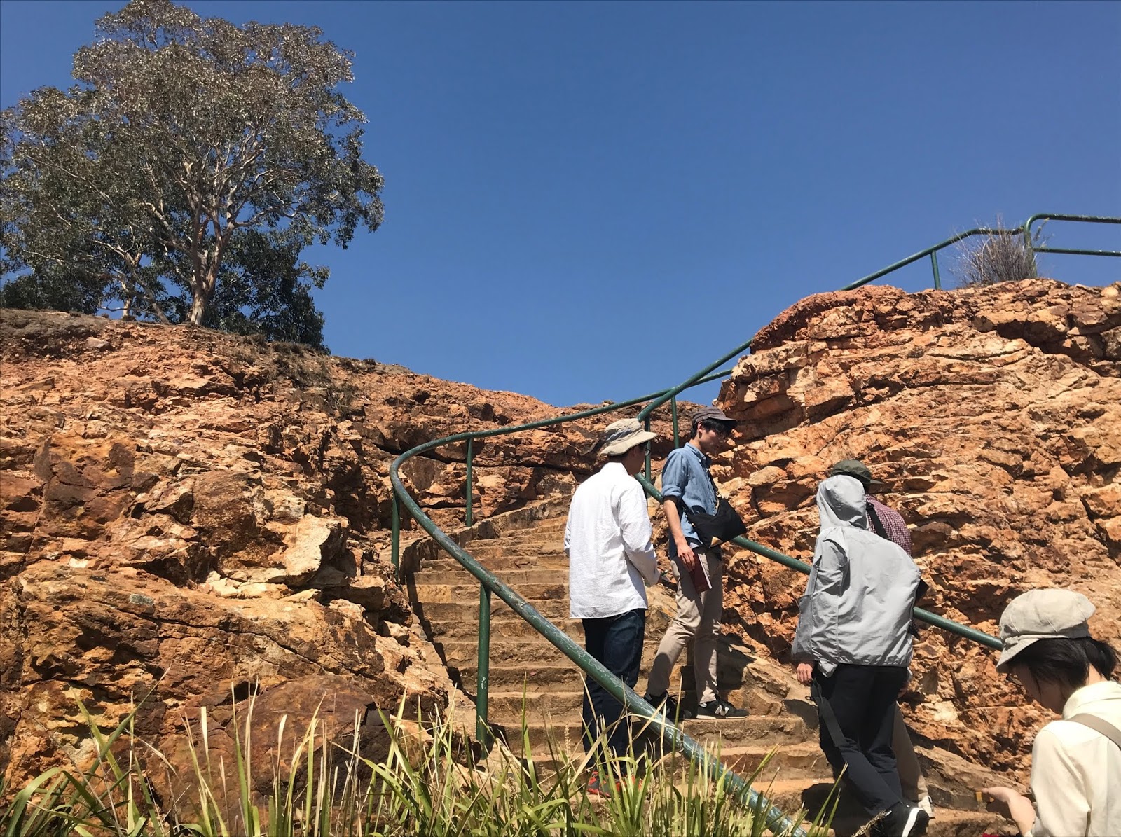
General report of the AUS field trip/国際研修Iレポート Day 4 (2 Mar. 2019)

こんにちは!太田です。
オーストラリアの巡検の様子をお伝えします。

Bingie Bingie
The snowy mountain that we visited yesterday was a major S (Sedimentary) type granite in the Lachlan fold belt. We observed the I (Igneous) type granite today. The I type is made by partial melting from the basalt in deep underground, according to Ca, Mg and enclave such as hornblende. I type granite can be able to sulfonate with magnetite. In Bingie Bingie, mingling, mixing, dyke of Xenolith, Gabbro and I type granite were mainly observed. In Bingie Bingie, mingling can be seen that granite and gabbro were consolidated leaving their respective compositions and were further mixed in a semi-solid state with low temperature.
Mixing seems to have caused the felsic part from the granite to melt out by felsic gabbro colliding with solidified mafic granite, resulting in dyke and new crystallization differentiation. From the results of dating, it is known that granite and Gabbro were formed almost at the same time. It is thought that the gabbro was formed when a melt penetrated consolidated granite. In this case, the intrusive rock becomes angular.
Dyke was thick on the sea side and thinner toward the land side. The surroundings of dyke are granite, and in the upper and lower layers rounded xenolith can be confirmed. From this, it is thought that Gabbro was taken in before the granite was completely solidified. Inside dyke you can see amphiboles, quartzes, xenoliths, and bubbles. Xenolith can be seen only in part, which seems that melt stacked during penetration and partial melting occurred inside dyke. In addition, structures were mixed such as amphiboles and gabbro originating from the shallow part such as rocks and bubbles which are thought to originate from the deep part, and we were very interested in the development process of dyke. The land side of dyke is narrowed to about 1 m in width, and multiple layers of vitreous clench can be confirmed up and down. It is thought that the glass was formed by rapid cooling, and since it has multiple layers, the quenching event occurred more than once.
Myrtle Beach
On the southern side of Myrtle beach, we can observe the turbidite which was deposited in the Ordovician 350-450 Ma, below the Sydney Basin. It is inclined from southeast to northwest. There are lots of turbidite, and since it was in the arc of the Gondwana continent, it is thought that the submarine landslide has occurred many times. Many folds were part of the Lachlan fold belt, and the turbidite was deformed under stress. On the northern side of Myrtle beach, unconformity can be seen above the sedimentary layer of Ordovician. It can be thought that there is an age gap of 10-50 million years with the unconformity between the top and bottom of the layer, but accurate restoration is impossible because the sediments are not continuous.
Permian sediments can be seen in the upper part. Sandstone is seen in the lower part, and fine sand to very fine sand classification structure is seen in the middle part from the bottom. There was also a layer of rounded coarse stones, which confirmed the cross-bed. It is conceivable that the sedimentary environment changed variously from shore to offshore. Angular boulder continues for more than 2 m in the upper layer, suggesting that there was a sudden deposition. As a cause, land slide, ice melt and flood can be considered, but there is little evidence. The upper layer of the Angular boulder layer is sandstone and it is thought that it returned to the coastal sedimentary environment again.


★Camp fire★
 We enjoyed camp fire after dinner! We had a special time with viewing stars with some alcohol!


2/28/2019

General report of the UTokyo/ANU field trip/国際研修Iレポート Days 1 (2. Feb. 2019)

Lake George
The water level of Lake George depends on the balance between precipitation and evaporation. Lake George had a record of flood till the 1980s, but now it has dried up. In past studies, water flowed from the surrounding river, but now the uplift had occurred, and river water hasn't come into the lake.
A lake was formed with elevation change due to a normal fault.
Lake Biwa is still active as it is still deeper, but Lake George is not active, so it is shallow due to sedimentation. The amount of sediment is about 300 m.
When dating with paleomagnetic, it can go back to about 5 million years ago.
In the last glacial period (20 ka), it is generally known that the sea level was as low as 150 m, but Lake George was wet. The bed rock was formed 450 million years ago, and the formation of 350 million years ago is visible.


Mt. Ainsile
 Canberra was designed by Burley Griffin at the international competition. There are three mountains around Canberra, Red Hill to the south, Black Mountain to the west, Mt. Ainslie to the north. All three were formed by the volcanic activity of the early Silurian. Black Mountain is the oldest, Red Hill is the youngest of the three mountains. Canberra is made in lowlands surrounded by these mountains, and Lake Burley Griffin is located in the center. Lake Burley Griffin is made by damming. There are old parliament building and new parliament building, new parliament building was made by cutting out hill. The Roads in Canberra extend radially around the new parliament building.
 We observed the outcrop of dacite. The crack direction is west, the portion that is 420 million years ago corresponds to the subduction zone of the end of the Gondwana continent. Trace of welding was seen in dacite, and it is thought that it remained as a mountain because it is harder than the surroundings.


State Circle Unconfirmity
Here are sediments of 425 million years ago. We observed the inconsistency between shale and sandstone.Lower shale has many folds, slump and pseudo-tachylyte. There was a part where the boundary between the shale and the sandstone was clear or not. The clear boundary was at a higher position then, and the sediments which were scraped did not remain on the spot. It is thought that the part which is not clear was the place where the sediments was settled down. In the upper sandstone layers, there are gravels with large particle size. It may indicate the sea level lowered or uplifted. Compared to the lower shale, the fold is weak, and the deformation received is weaker than the lower layer. We interested in the formation mechanism, because both normal fault and reverse fault were observed.
Pseudo-tachylyte: Part of the rock melted due to the frictional heat generated by the fault and reconsolidated as a glass dike.

2/25/2019

New Papers 2019 February 18 -24 (AGU, EGU, GSA)


Geophysical Research Letters
1.         Radiative effects of secondary ice enhancement in coastal Antarctic clouds
G. Young  T. Lachlan‐Cope  S. J. O'Shea C. Dearden  C. Listowski  K. N. Bower T. W. Choularton M. W. Gallagher

2.         Intensification of El Niño rainfall variability over the tropical Pacific in the slow oceanic response to global warming
Yang Zhang  Tao Zou  Yongkang Xue

3.         The Dominant Role of Extreme Precipitation Events in Antarctic Snowfall Variability
John Turner  Tony Phillips  Meloth Thamban  Waliur Rahaman  Gareth J. Marshall  Jonathan D. Wille Vincent Favier  Holly Winton Elizabeth Thomas  Zaomin Wang  Michiel van den Broeke  J. Scott Hosking Tom Lachlan‐Cope

4.         Influence of Arctic Sea Ice Loss in Autumn Compared to That in Winter on the Atmospheric Circulation
Russell Blackport  James A. Screen

5.         Atmospheric Circulation Response to Anomalous Siberian Forcing in October 2016 and its Long‐Range Predictability
Nicholas L. Tyrrell  Alexey Yu Karpechko  Petteri Uotila  Timo Vihma

Climate of the Past
6.         The 4.2 ka BP Event in northeastern China: a geospatial perspective
Louis A. Scuderi, Xiaoping Yang, Samantha E. Ascoli, and Hongwei Li

Geochemistry, Geophysics, Geosystems
7.         Reef‐scale‐dependent response of massive Porites corals from the central Indian Ocean to prolonged thermal stress – evidence from coral Sr/Ca measurements
Maike Leupold  Miriam Pfeiffer  Dieter Garbe
‐Schönberg  Charles Sheppard